Wednesday, December 12, 2012

15 Minutes A Day


I set out to write a blog post a day in 2012. It’s December 12 and I’ve reached the grand total of 44 posts. That’s an average of 3.6 per month. If I could look back on the me that started the challenge in January, I would probably feel disappointed that I didn’t make my goal. But the me that’s sitting in the now of falling short of my intention feels totally fine with my shortcomings – if I should even consider them such.

I realize that it was important to have the goal to strive toward. I did do more writing in the early part of the year, before I started dating Marcus, before I started writing even more for hire, and before I undertook more consulting projects.

I know that writing is an important exercise. Especially writing for myself. Writing my stories. Writing my experiences. Writing my truth. That’s something that writing for hire can’t do. When I work for someone else, it’s in my words, my style, my ideas on structure and organization, but it’s not the same as deciding this is 100% the most important thing to share with the world. It’s not necessarily my optimism, my joy, and my hope (though I do strive to find work projects that allow the good to shine through, because we have far, far too much bad news in this world).

This morning I was at the gym reading a magazine, and I read something about a woman who wrote ten books while working a full-time job. Ten. She wrote these ten books by writing for just15 minutes each day. 15 minutes. Every day. Her work. Her projects. Her books. She didn’t spend the whole day on it. She didn’t have time. She spent what she could eek out. Perhaps it was the first 15 minutes upon waking, or 15 minutes after a morning run, or 15 minutes after dinner. But the accumulation of 15 minutes, daily is 91 hours and 25 minutes in a year.

Really her challenge was not much different than the one I set out to tackle at the start of this year. A book, like a blog, is an accumulation of words, thoughts, and ideas. A book is a bit more refined because it’s organized in a cohesive manner, but a book and a blog are the same beast. They’ve got the same bones.

I return, again, to my 15 minutes.

Monday, October 15, 2012

The Courage of Discourse


I got a handwritten letter today. The letter came from someone I’ve never met. Carol lives in the nearby town of Marshall.  While I’m not sure how she got my address, I’m glad she wrote.

She wrote me this letter, explaining some of her decisions to vote democratic and for Obama in the upcoming election.

A letter from Carol Dixon
Before I opened the letter I considered it. I wondered if this hand written envelope enclosed a letter from someone espousing political views. Before I even opened the letter I thought about the fact that we do need to be using our voices, our pens, and the tools of communication to share our opinions with our neighbors.  We don’t have to agree, but we should feel empowered to discuss our ideas, even if those ideas are different from those of “our” established political party lines. This is the power of democracy that I feel is commonly overshadowed by media pundits, the commentary of editorial talk-show hosts, and the pervasive and simplistic arguments of “We’re right. They’re wrong.”

Not knowing what the letter would be before I opened it I decided that no matter the position presented, I would reply with a letter that acknowledges her feelings and opinions, and thanking her for writing to start the dialogue.

Thankfully, I opened the letter to find it expressed her personal opinions. Based on her life and family experience she intends to vote a straight democratic ticket.

What I didn’t find was a finger pointing at me with “you should” or “what you don’t know…” that I feel has slid into political discourse. That kind of dialogue devalues the listener. It supposes you are incapable of a decision. It supposes that you’ve given no thought or consideration to your experience and what you witness in your life. We all have opinions, experiences, and feelings. If we tune in to what’s inside us instead of repeating arguments or ideologies conveyed by the media, we’d be much closer to the democracy we claim to be part of as Americans.

I love that she wrote to start a conversation among her neighbors. I love that she wrote for what she believes in, based on her experience, to members of this county that are largely republican, and I love that she spent her hard earned money on the paper, envelopes, and stamps to send this mail to people.

I deeply respect that she has opened herself up to the dialogue with her neighbors, those who agree, and those who disagree. It may produce mail that is filled with vile and bitter tones, rather than a calm response of personal opinion in opposition that makes up a true discussion. Regardless, she has knowingly opened the door to this discourse, and I admire her courage.

I talk politics sometimes, but I generally do it in the company of close friends or relatives. I don’t generally use Facebook or Twitter for sharing my political opinions because I believe its purpose is to connect people, not divide them (and our current political structure is very divisive). But Carol’s letter reminds me that as long as what I present is my opinion, my feelings, based on my experiences, it’s a fine idea to talk politics, because this type of discourse is the cornerstone of our nation.

Perhaps, I’ve taken to heart the expression to not talk about religion, politics and money (or is it sex) in mixed company, to garner a more peaceable existence. Then again, if I do that am I short-changing what it means to live in a democratic society?

What do you think? Do you talk politics with your neighbors? Why? Why not? 

(I seek a civilized conversation. All comments are welcome as long as they are thoughtful arguments rather than combative assaults on a difference of opinion.)

Wednesday, October 10, 2012

Interview with PCT Thru-Hiker Anne Tully


Anne is a 2008 Appalachian Trail thru-hiker who said she’d never hike another long trail after completing the A.T. Two weeks later, she thought she might want to hike the A.T. again, but then didn’t give it much more thought. 

Four years later the urge to hike another long trail hit her hard. She started planning for the PCT at the end of 2011, and she and I met in March 2012 to talk about the similarities and differences of her experience on the A.T. and what she could expect on the PCT.

We talked again last Saturday, and I asked her about her experiences on the PCT and insights she gained on her 2012 PCT thru-hike.

When did you start at the Mexican border and when did you get to the end in Canada?
I started on April 20 and on September 4 I had made it to the border. I left through Manning Park on September 5.
Anne's trail name is Stride.
 I was talking to my aunt the other day, and realized, all of that is 2,700 miles.

What are your overall impressions of the PCT?
It’s interesting for me because I hiked a lot of it as a solo hiker. That’s a totally different experience than my A.T. hike where I had people with me. I walked at least 1/3 of the PCT alone and spent nights by myself. Northern California was the longest stretch where I was by myself.

When I look back at pictures I am taken back by how absolutely beautiful it was on the PCT. Moments I stopped in my tracks and was just literally in awe, but it didn’t make up for the fact that the trail was hard. When I talked to people before my hike, people told me I wouldn’t experience the physical pain of the trail because of the beauty. People romanticize the trail, in particular, the high Sierras. In fact, I think the Sierras were more difficult for me mentally; I became resentful because it was beautiful but it wasn’t enough to take the pain away.

At one point I was talking to [trail legend] Billy Goat, and he gave me the lesson I took away, to “take the trail for yourself.” Don’t allow other people to formulate your experience based on their experience.

There is stunning scenery, but you have to go in with the blank slate, without expectation, because it will likely be more difficult. If you go in with a romanticized vision you could be disappointed.

What was the best part of the hike?
Goat Rocks wilderness in Washington State is for sure a section that has stuck with me. When we went through the weather was perfect, the wildflowers, the lupine, were in full bloom. One fella I met had lived in the area for 57 years said he’d never seen the lupine in full bloom like that, ever. We had beauty of wild flowers everywhere and jagged rocks. You could see Mt. St. Helens and Mt. Adams you just finished walking around. Then, BAM!, Mt. Rainier. It was spectacular. There was lots of ridge walking there, and I liked that. 

In Oregon I liked the Three Sisters and Mt. Jefferson, and in California, Muir Pass was my favorite. I was blown away. It was one of the first times I felt truly stunned with what I was able to experience and live in.

What was the hardest part of the hike?
After I left Ashland Oregon alone, I was by myself for next three and a half days. Physically I was so tired. I had been doing 30-mile days in northern California. There were hikers ahead of me and hikers behind me. I couldn’t go any faster than the 30, 32, and 35-mile days I was doing in Oregon. I couldn’t slow down for people behind me to catch up because I was on a deadline to finish so I could return to work on time. I was by myself, feeling mental weariness. I was just struggling to stay in the game. I was hard on myself too. I just wanted to quit.

When I got to Crater Lake I really wanted to stop, and ask some tourist to take me away.

It was a time of growth, because I realized that I didn’t have a guarantee to finish the trail. It doesn’t matter how tough you think you are.

What kept you motivated to continue?
When I got to Crater Lake, I got food, and picked up my mail, but my maps weren’t there. That was almost the straw that broke camel’s back.

At the same time, I got mail from friend of mine that had letters of encouragement from other people. I sat outside and read all the letters. I was truly humbled that people would write me letters, and words of encouragement. There were letters from people I didn’t know. Those letters were awesome.

After that I had to go to the hiker box at the store. While I was there I talked to this girl, Jenna, and told her I was having a hard time. She and I talked for 5 or 10 minutes while I finished packing my food. She came back 20 minutes later with words of encouragement, energy bars, and invited me to her campsite for dinner. I ended up spending the night at her campsite.

It’s those kinds of interpersonal relationships with people, either in letters, or dinner with Jenna that kept me going. It was a rich experience to share life with people I wouldn’t have otherwise met. It was a beautiful experience that just connected for me, and gave me a morale boost.

What advice would you offer someone planning or starting a PCT thru-hike?
Try to touch base with as many people as you can who have hiked the trail to learn about their experience, but recognize that the weather is so variable. I talked to you, and you had a lot of snow. I didn’t have much snow but I had a ton of wind. A ton of wind. It was scary.

Be flexible in your mind. Maintain inquisitiveness the whole way. Ask people you meet along the way questions. I learned that people on the trail are very creative with their gear.

Lastly, be aware that there’s an obsession with ultra light hiking gear on the PCT. I probably, realistically, had forty people say, “wow, your pack looks heavy.” Even into Washington where I had walked 2,400 miles, they were still amazed. Ultra light isn’t for everybody.

I had a man challenge me about my tent, then lecture me about the number of ounces over 3 pounds. Ounces aren’t going to make or break my hike for me. That’s not important to me, but it was really important to him.

I encourage people to research it, learn from people, keep some perspective, and be confident in what you decide works for you. Be ready to pop off sassy comments; because people don’t get off the ultra light soapbox, I had to have my own.

The Northern California blues actually happened. It took me three months and week to walk California, two weeks for Oregon, and three weeks for Washington.

What did you do to prepare for the trail?
I felt really overwhelmed. I had a back injury the year I decided to do this. I had a strong conviction about hiking, so I took a slow, patient approach to physical activity until my back healed up. I did some running, and I did three day-hikes up to Wesser and back with food in my pack. I didn’t do much training.

From my Appalachian Trail experience I knew that if you are slow from the beginning, the trail will kick your tail into gear as it needs to be. Nothing prepares you for the trail except the trail. If I took it slow and mindful in the beginning my body would acclimate.

It takes realizing that the first couple of weeks does feel like work and is hard.

I had to be sensitive to the transition from normal life to trail life by understanding that I may feel overwhelmed at moments, because of the east coast to west coast culture change, by going alone, walking through the desert, and the elevation of the Sierras.

I had to start by learning about the first part of the trail, and then take the rest of it as it comes after that.

It’s cool when it moves from a feeling of working, to a feeling of a lifestyle. Eventually at some point you wake up robotically, pack up and start moving. You embrace it and enjoy it.

The same thing happened on the Appalachian Trail, where I felt like I can do this forever.

Thursday, October 4, 2012

Name change

I just changed the name of the blog from "Shadow of the Moon" to Leanna Joyner.

May's Super Moon viewed from the Blue Ridge Parkway.
Shadow of the Moon referenced my trail name "Moonshadow" that has been my alter-identity on long-distance trails, the Appalachian Trail and Pacific Crest Trail, and in trail circles for nearly ten years.

Maybe one day I'll write about how I got my trail name, how it stuck, and my general thoughts on trail names as part of the hiking subculture, but for now, suffice to say that this blog is an outward expression of myself in this world, as so it will be named.

There's another reason, too. When I started this blog I wasn't sure what my presence would be online. I was wary of identity theft, unsure of my posting frequency, or if anyone but friends and family would read it. I'm moving beyond the anonymity I one sought here to claim the voice and opinions that I share.

Thanks for sticking with me along this journey. I'm having a lot of fun with it so far and hope to bring you much, much more.

Wednesday, October 3, 2012

Be, Don't Do

Sometimes the things I need most seem counter-intuitive to what I think I need to do.


See, pressure around here has been mounting. I've been adding more projects to my plate, and they're all things I really enjoy doing. I've been giving presentations, writing for various publications, attending trainings, and organizing Joyus Groove classes. I've been settling in to a relationship with Marcus that's feeling good and solid and true; albeit, just like any relationship, it requires time, attention, and nurturing.

Meanwhile, he's been finishing his patio and putting finishing touches on his tiny house. For a while we were really stressed, spiraling in a place of new busy-ness as we simultaneously juggled our own worries and responsibilities.

It's in those times, with activities seemingly closing in around me like a tight corset, making it hard to breath, when it's hardest to find the latch and step outside. 

The singular salve that makes everything better, hiking. It's just there...outside the door, with a map, a bottle of water, an apple, a jacket, my headlamp (in case it turns dark), and my boots.

Marcus and I finally did just that on Sunday, barely speaking to one another for listening to the wisdom of the experience, Mother Nature, and our quieting minds.


When I get filled up with what I think I need to do, hiking helps me remember how to be who I am, and that, for me, is its greatest lesson.  


We drove to Camp Creek Bald and hiked to Firescald Knob along the Appalachian Trail. I think we'll return again this Saturday to hike a loop from the river up to the ridge, exploring more of Shelton Laurel, an area I've talked a lot about in my presentations lately.

Friday, September 28, 2012

Take a Tiny House Tour


I'd write something about this, but I've spent too many hours learning everything I needed to know to edit the audio and make a video. I hope you enjoy it. I find this to be a super fascinating project. We talk about Marcus' inspiration, original design, construction process, and costs.


If you can't view the embedded video, you'll find it here on YouTube

SmallerHouseLargerLife.com is under construction. If you'd like to contact Marcus Barksdale, reach him at smallerhouselargerlife@gmail.com.

This is my first audio and video editing project, ever. Please excuse all its imperfections. I blog about this and other things that interest me right here and as often as possible.

Thursday, September 27, 2012

I've Got a Book!

I've been kind of low key (okay, almost silent) about the fact that I researched and wrote a book with the working title Hiking Through History for the Appalachian Trail Conservancy. It's time I open up.

The fact is, I was waiting for the big "reveal." I was waiting for the book to materialize from its long metamorphosis from digital manuscript to bound form to validate me, as a historian, writer, author. I was waiting to ask for your support once it came out, to invite me to speak, purchase my book, and spread the word.

But I'm really excited for it, and I want to make it a reality, soon (as in edits finalized, layout complete, printed, and in your hands).  

I just made my third presentation on the book. I've presented at UNCA-Asheville, the Madison County Geneological Society, and, tonight, the Franklin Library. I'm honing my presentation, and I'm owning the fact that I've written a book. I'm amped! I got home two hours ago, and I'm still running off the excitement of sharing the the Appalachian Trail and the history I discovered. 

So, let's do this, shall we?

If you are interested or may ever be interested in my book, sign up with your interest here so I can demonstrate interest and support. Together: you, me, the Appalachian Trail Conservancy, we'll make this a reality.

Thanks,
Leanna


Monday, September 24, 2012

Resupply: The Appalachian Trail v. The Pacific Crest Trail

The Appalachian Trail Versus the Pacific Crest Trail: How to Pick Your Pleasure, Part Four

They weren’t designated the first National Scenic Trails for nothing. These two premier hiking trails are designed specifically to impart the beauty of their landscapes (seriously, trail builders think of these things).

Both are excellent choices, so whether you’ve finished hiking one of them and are ready to take on the next, or are simply deciding which one to hike for your first-ever thru-hike, here are some discernable differences that make each unique.

Town Stops & Resupply: While this won’t make or break a decision to hike one of these trails over the other, resupply is an important component of a long-distance hike, and these two trails are really different when it comes to resupply.  

A hitch in Maine
The A.T. has resupply points in high frequency, and they are generally only a short distance from the trail, which means hikers can carry less food and stop more regularly to resupply. Communities near the A.T. often have a pretty good awareness of hikers, and they’re fairly willing to pick up hitchhikers coming in to town, or returning to trail. Trail towns do a pretty good job of stocking what hikers need, and there are hostels and hotels that cater to hikers, offering discount rates for overnight stays.
The long wait. The hitch into Mojave finally ended with a ride in the police car. Thankfully the patrolman looks out for hikers in need of a ride so they don't become casualties of the intense roadside heat.
The PCT doesn’t have quite the same level of awareness among drivers, and the towns are further from the Trail, which means longer waits while hitchhiking and longer rides once someone picks you up. The bigger resupply stops do carry standard fare for hikers’ diets, but there are a lot of smaller stops where you may still need to rely on a mail drop.
I got a hitch with these nice fellas near Wrightwood, CA.

Even if hiking solo, hitchhiking to towns in pairs is the safest approach. I take this precaution seriously as a female hiker. While it’s not always possible to hitchhike with others, the fact that more people hike the A.T. means that there are generally other hikers around when you get ready to hitch to town, or back to the trail. In all cases, use your gut. If someone seems odd, by all means, find a reason to get out of taking them up on their offer for a ride ("Oh, I just remembered that I think I left my camera back at my last stop on the Trail...Gotta get it. Thanks anyway!")

Trail Guides: When planning and hiking, here are my recommendations on the best resources for each of these trails. I would use them in these combinations.

Pacific Crest Trail 
Water report (I'm not sure about the future of this site as the person who compiled the information passed away in August. Hopefully another PCT enthusiast will undertake the effort in his absence.)

Appalachian Trail


This is the final installment of a four part series on the differences between these 2 trails:
Part One: People
Part Two: Elements
Part Three: Trail terrain, views, snow
Part Four: Resupply

Do you have experience with both of these trails? What do you think are the biggest differences? 

Saturday, September 22, 2012

True or False: the A.T. is hard; the PCT is easy

The Appalachian Trail v. the Pacific Crest Trail: How to Pick Your Pleasure, part three

They weren’t designated the first National Scenic Trails for nothing. These two premier hiking trails are designed specifically to impart the beauty of their landscapes (seriously, trail builders think of these things).

Both are excellent choices, so whether you’ve finished hiking one of them and are ready to take on the next, or are simply deciding which one to hike for your first-ever thru-hike, here is one of several discernible differences that make each unique.

The Trail: I’m talking treadway or footpath here. Every A.T. hiker hears that PCT is so much easier to hike. Every PCT hiker hears that the A.T. is like walking through a green tunnel. So, let’s get all this out in the open.
Gradually graded Pacific Crest Trail in Southern California

The A.T. is hard. The PCT is easy. These generalizations, like most, don’t tell the whole story. The Pacific Crest Trail is primarily more gently graded than the A.T., and this difference is most starkly apparent at the outset of a northbound thru-hike, whether you start at Campo, California, or Spring Mountain, Georgia. While most hikers intend to train for their hike (and some do) most set out on a trail having scrambled to organize the rest of their lives so they can leave to fulfill their dream, often starting out with good intentions but not a lot of strength in their “hiking legs.” Plus, it’s my opinion that there’s no better training for a thru-hike than a thru-hike, but that’s another post entirely.

The difference at these trails’ southern terminuses means you may be able to easily hike 15 to 20 miles on day one in California, where you may only be able to hike 6 or 8 in Georgia. The difference is elevation change and the grade of the trail, but to generalize and say all of the PCT is easier would be going too far and excludes other factors of a PCT hike.

The fact is the PCT through the Sierras is difficult, given the altitude, terrain, river crossings, and snow; it’s not always a cakewalk. In the same token, the A.T. isn’t always a steep ascent and steep descent; there are rolling meadows, riverside ambles, and ridgeline walks. They both have their unique challenges, so let’s not get crazy with generalizations.

Sure, you can hike longer mile days on the PCT with a bit less fatigue, but you also need to cover 400 more miles on that trail in a slightly shorter window of time than on the A.T. (2,180 on the A.T. vs. 2,600 on the PCT).

Green Tunnel v. Views for Miles: I like to think of the Appalachian Trail as an experience in minutia, all the small wonders that make up this grand spectacle of nature; this includes walking through fog-shrouded tunnels of rhododendron grown so tightly together that I feel like I’m walking through a fairy tale. There are amazing views to be had along the A.T. from rock outcroppings and mountain summits, but they are the special features of the Trail, not necessarily a daily requirement. If they were on the food pyramid, amazing views would be the decadent dessert that you get in moderation, while walking in the rest of the experience provides well-balanced nourishment.
See the whit blaze on the rock in the center? Yes, this is the
Appalachian Trail in Pennsylvania. (I love to dispel the
generalization that ALL of Penn. is like this though.)

The PCT offers views for miles around. In fact from where you walk, you can often see the trail ahead snaking off into the distance. This has the potential to inspire as well as discourage you, especially if you are tired and know your destination is far beyond sight. From every place you stand, you can take ten amazing photographs, easily. The key in such an environment is to find awe in the landscape that is perpetually on display.

Because you can become desensitized to either the vast beauty laid out before you on the PCT, or the forest’s secret wonders and “special features” on the A.T., it’s best to steer clear of comparing the apples and oranges in this regard, and just accept them as designed.

Snow: As a Southerner the snow took me by surprise on the A.T. and the PCT, at different times and in different ways. Here’s how:

On the Appalachian Trail, assuming a start date before April, you will likely get snow. While other areas of the Southeast may see not one white flake, A.T. hikers will get a dusting, if not a dump, because of the elevation and the likelihood for the mountain tops to “catch” and stall the weather system. Hikers starting in February or March often get snow in Georgia, North Carolina, and Tennessee, most notably in the Great Smoky Mountains National Park. These spring snows are wet and heavy, and can come unexpectedly (like following several days of spring sunshine). Like any other time on the A.T. it’s important for hikers be aware of their condition and follow tips for preventing hypothermia.
I awoke to this snowfall the morning I walked into North Carolina.
On the PCT, you will encounter snow. It’s a matter of when and where. The thing I was least prepared for and learned the most about was snow and snow traversing, because I was traveling across som near vertical snowfields. The terrain that offers views for miles is the same terrain that means there are no big trees to cling to should you slide down an icy slope . A slip without knowledge of self-arrest techniques could have been deadly. As it was, I was uneasy and less than surefooted on that terrain. While snow conditions differ from year to year, when I hiked there was a lot; I must have walked three miles through snow to reach Muir Hut and another five or six in snow after the summit celebration.
On the PCT
If I had to do it all over again I would have taken some mountaineering courses on snow and snow travel before my hike (and when I do it all over again, I will).


My trepidation for traveling in snow without my ice axe (I needed it much sooner than I thought and had sent it much farther ahead), led me to make a penny wise, pound foolish mistake. My friend Morph and I skipped around snowy San Jacinto and Fuller Ridge to a section farther north because I didn't have an ice axe. I should have bought one at the outfitter and kept hiking. As it was we spent excessive time and money hiking a more northern section, then returned later to re-capture this missing section of the Trail.


This is part three of a four part series on the differences between these 2 trails:
Part One: People
Part Two: Elements
Part Three: Trail terrain, views, snow
Part Four: Resupply 

Thursday, September 20, 2012

The Elements: Appalachian Trail v. Pacific Crest Trail, a Guide to Picking Your Pleasure, part two

They weren’t designated the first National Scenic Trails for nothing. These two premier hiking trails are designed specifically to impart the beauty of their landscapes (seriously, trail builders think of these things).

Both are excellent choices, so whether you’ve finished hiking one of them and are ready to take on the next, or are simply deciding which one to hike for your first-ever thru-hike, the elements comprise one of several discernible differences that make each trail unique.

The Elements: The Appalachians and the Pacific Crest are different mountain ranges with distinct landscapes and climates that influence these elements: earth, wind, fire, and water.

Earth: On the A.T. the world beneath your feet is red clay, rocks, and roots (from Georgia up to the mid-Atlantic), or boggy and bedrock (in the northeast). As a 480 million year old mountain range, it's stable ground.
Bedrock of the White Mountains of New Hampshire

The PCT is sandy and shifts beneath your feet. Yes, sandy sidehill slips out from under you along canyons; additionally, the ground may literally sway beneath you as you drift to sleep. If you aren’t accustomed to quakes before your PCT hike, you will develop a sense for them. I felt three earthquakes in two-months.

Wind: The A.T. doesn’t have anything on the PCT when it comes to wind. This PCT element is a force to be reckoned with. I read recommendations for wind shirts or jackets in Yogi's PCT planning guide, but I should have taken the advice more seriously, very seriously.
It's no wonder you hike in sight of windmills on the PCT.

Fire: Gathering around a fire with friends is a primal and communal activity. It’s nostalgic, but it’s generally not practical on a thru-hike. After all, who wants to hike all day, and then collect firewood? But I’m writing more than just about campfires when I talk about fire. It relates to camp stoves, too.

If you like a hot meal, if you like gathering around a campfire, and if you like hot coffee on trail, the A.T. has a lot more to offer. Why? Because, as my friend Morph has said, the PCT is a tinderbox.
Burned forest. It's a frequent occurrence on the PCT.

In 2012, there were 11 fires that effected or closed sections of the PCT. Given that conditions are drier in the west, coupled with the aforementioned wind, it can be dangerous and unwise to build campfires, and sometimes even cook a hot meal on what would otherwise be a safe camp stove. It’s your judgment call once you’re out on the trail, but I signed and took seriously a permit to hike on the PCT that said I would be responsible to pay for containment and clean-up of any fire I caused. Sometimes this meant giving up the option to warm my instant mashed potatoes.

Water: Call me a water angel because it seems that in the years I chose to thru-hike, water was abundant. I hiked the A.T. in the rainiest year on record, and the PCT in 2010 was experiencing a very wet spring. That being said, water resources are always more abundant on the A.T. than the PCT. There are long stretches of the PCT through the desert where natural sources can’t be relied upon; this generally requires hikers to carry more water for longer distances.

(More about my initial impressions on PCT elements are found on my Trail Journal site. Please excuse the typos, I haven't edited it since my transcriber originally posted it. Sometimes she just couldn't make out my scrawl.)

This is part two of a four part series on the differences between these trails:
Part One: People
Part Two: Elements
Part Three: Trail terrain, views, snow
Part Four: Resupply

Wednesday, September 19, 2012

Appalachian Trail v. Pacific Crest Trail: A Guide to Pick Your Hiking Pleasure, part one: People or Wilderness

They weren’t designated the first National Scenic Trails for nothing. These two premier hiking trails are designed specifically to impart the beauty of their landscapes. (Seriously, trail builders think of these things.)

I awoke to this sunrise after literally sleeping alone under rocks on the PCT.

Both are excellent choices, so whether you’ve finished hiking one of them and are ready to take on the next, or are simply deciding which one to hike for your first-ever thru-hike, here is one of several discernible differences that make each unique.

This analysis is based on northbound thru-hikes of both trails. A southbound hike of the Appalachian Trail offers some distinctions from hiking Georgia to Maine that will offer a completely different experience. (I'm happy to discuss those differences with you.)

The People Factor: The Appalachian Trail has shelters and designated campsites along the way. The Pacific Crest Trail encourages distributed camping by not formalizing camps.

Here’s how it impacts your trip:

Lots of good people, many I still count as best friends, at Eagles Nest Shelter in Penn. in 2003.

On the A.T. shelters tends to organize hikers into condensed clumps, yes clumps, of hikers.  If you stay at shelters or camp nearby them, you may hike alone all day, encountering some hikers along the way, but rest assured, you’ll get to swap stories over meals around the campfire before you snooze. It’s a perk for the extroverts among us, but can be overwhelming to people who came to seek fellowship with the wilderness, as the shelter environment can breed an almost party-like atmosphere, especially within the first 500-miles of the Trail.

I slept alone under these rocks on May 4, 2010 as this spot afforded the most protection from the relentless wind.

On the PCT there are a few formalized campsites, and others that naturally develop around water sources. Without heavily established sites, hikers on the PCT tend to walk until they are ready to stop, rather than walk to an established “destination” for the day. Also, fewer people start thru-hikes of the PCT every year than on the A.T. Given these facts, if you start any time after the ADZPCTKO, you will encounter fewer hikers during the day and at night. It takes a bit more planning to camp with people you enjoy spending time with on the PCT given the low-impact nature of camping, especially if you like to hike alone much of the day.

This is part one of a four part series on the differences between the PCT and the A.T. Tomorrow, I'll discuss the elements. Not the weather, but earth, wind, fire, and water. After that I'll cover terrain, snow, and resupply. If you have requests for other topics, please let me know.

Thursday, August 9, 2012

Everything I Need to Know about Life I Learned on the Appalachian Trail

I was listening to Krista Tippett’s On Being interview with Sarah Kay about the power of words, and Sarah explained an exercise she uses as a prompt when working with students to cultivate their self expression. (She used it in her TED talk, too.) The prompt is to answer this: What I know to be True.

When I thought about what I know to be true, it came to me that everything I ever needed to know I learned by hiking the Appalachian Trail, all 2,172 miles of it in six-and-a-half months. That is where this begins.

The end of the Trail, October 4, 2003.
Life isn’t in 4 walls: It isn’t the house that surrounds us. It isn’t in the office where we spend the majority of our days, positioned behind a computer. It is outside in this vast compendium of earthliness – from the smallest critters, like ants, centipedes, and chipmunks – to the calm of a deer grazing without notice of your presence – to the fierce protection a mother grouse has of her nest – to the magic of a bear in his element, his home, not one constructed of four walls, with regular feeding time. The minutiae of the organisms in the dirt. The sun. Time spent in such regular contact with the moon, daily knowing her waxing and waning. By four walls, I also mean the constructs of our society that keep us chained to our “place,” items of imaginary importance – politics, war, violence, “trending” news – like celebrity marriages and children. Why is any of that more important than what we can witness and experience for ourselves, separated from all of that?


Appreciate everything: Seriously, if you can’t find reasons to be in love with something through endless days of rain, there isn’t a way you can complete a six-and-a-half month hike on the Appalachian Trail. Just like life, it has its highs and its lows (sometimes more lows). I couldn’t have completed my 2003 thru-hike during “the rainiest year on record” without a positive outlook, which sometimes meant creating things to be thankful for. Optimism, yes, positive outlook mixed with hope for good to come, goes a long way toward fulfillment.


I am everything. Everything is me: I grew up with Christian principles, and I learned this distinctly eastern philosophy through my direct experience in my 25th year on this planet. It’s hard to capture in a snappy paragraph, but it was hard-won knowledge that left me feeling more compassionate toward the earth and all her animals, including my fellow humans and myself.

I started to connect that if we treat the earth poorly, in our industrial food production systems, for instance, that it returns to us, with unhealthy food choices and unhealthy bodies. I reasoned that we don’t know our food any more. (This was prior to my familiarity with the slow food movement, Animal, Vegetable, Miracle or Omnivore’s Dilemma. I was still a conventional food consumer to the core before my hike, unaware of the food practices plaguing the natural seed banks of our nation.) I suspected that animals carved and sold to us in Styrofoam on things that look like maxi-pads to soak up the blood were part of our disconnect with what we ate. How could we appreciate our food when we didn’t know where it came from? If we couldn’t even bear to see the sight of its blood?

The food system is just one example of the awareness that bubbled up in me during my hike, of the connectivity of life and life cycles on this planet. I became more distinctly aware of my connection to my ancestors (then living and dead), to what impact my words, my “footsteps”, and my actions have on everything and everyone around me. I continue to learn this life lesson; it’s a big one.


The trail gives you what you need: It’s an expression that litters the trail, just like those silly little corners from granola bar and candy wrappers that tend to slip out of fingers or pant pockets (so watch you don’t loose yours). Experienced long-distance hikers dispense this nugget like yoga teachers spout ancient Sanskrit text or Christians throw around John 3:16. It is THE BIGGIE! But hearing it and living it are two different things. I learned it then, but must continually revive it for myself in my off-trail life – faith. It’s nothing but faith.

I started my hike with faith founded in my Lutheran upbringing and the idiom my momma dispensed “God doesn’t give you more than you can handle.” But before long I came to trust the expression of the trail delivering what I need much more, because the challenges were harder than anything I had faced before.

I had to trust that entering the heavy spring snow of the Great Smoky Mountains I wouldn’t die of exposure, and that I had the right gear and knowledge to stay safe. I had to trust that a wild animal wouldn’t carry off my food, and if it did I could survive. I had to trust that I wouldn’t get lost in an attempt to cross-country navigate in the 100-mile wilderness of Maine. I had to trust that despite walking through a sunken trail that resembled a river and endless days of mud that I wouldn’t develop trench foot or hypothermia. I had to trust that being scared out of my wits by an aggressive grouse was precisely what would be best for me at that moment. See, this phrase didn’t just say “you can handle it” it also went a step further to suggest that it’s necessary growth. It’s what you need.


And, while the trail gave me challenges and obstacles (like scaling vertical ladders on sheer rock faces of New England), it also gave me things like lakes for swimming on a few perfect, sunshiny days, flying a kite from a canoe, easy hitches into town with kind strangers, the soaking rain of a thunderstorm just after I arrived at a shelter, and friends showing up in unusual places. These things, too, were just what I needed, when I needed them.

What if we look at all of life as a perfect dose from the Universe of what we need, trusting that it will all work out? Faith, trust, hope – that’s about all we can do…Oh, and love.


There is no perfect time: There’s now. On my hike I encountered people who lamented not being able to go on a long hike. The secret, the hidden truth, I came to understand after a few conversations that started this way, is that hiking (or insert your dream here….) is accessible to all of us. Each of us can save a few thousand dollars to hike, find a way to jump off the ferris wheel of “life as we know it” and get on the trail. When we leave, things continue. The world doesn’t stop because we we aren’t there to attend meetings, answer the phone, or meet for drinks at the bar on Tuesday. Family, friends, employment, and house…all of it will be there when we come back. But there’s too much that’s fleeting in this life not to go now, especially if it is what you want. This goes for anything, writing a book (write!), dancing (dance!), learning to fly (get a lesson!). Don’t wait. There may never be a better time than right this instance!

Another way to say it: there is fear and the excuses bred by those fears, and there is doing. Please, for the lova’, be a doer! (Note: I reminding myself of this lesson again and again and again…preachin’ to me and you!)

_________________________________________


What do you know to be true? 

(Sarah would challenge you to elaborate. Don’t write just one word, but explain what it is, where it comes from…Go! You have 2 minutes!)

Monday, June 11, 2012

Havin' Fun, Hon

-->
Christina and I met when I lived in Northern Virginia and DC a little over ten years ago. I'm so appreciative for our lasting friendship, and the opportunities I get to visit and reconnect with her. 

I arrived at the Christina and Rob’s home Thursday and with enough vespers of daylight left for Christina and I to take Chapman for a walk through the neighborhood. That evening I checked a couple books out of the Swanwick lending library, including Musicophilia that explores how music interacts with our brains.

Friday morning while they took care of a few household matters and work meetings, I took a run on the C&O Canal. I chatted up a neighbor on the return portion of my run because we were both out enjoying the beautiful day. By mid-day Rob and I escaped the vortex of the city traffic and high-tailed it to Annapolis in my zippy little 5-speed. Christina still had work to finish up before she could join us. 

Once we got to the dock, Rob still had more work to do. Luckily, I’m an easy-to-entertain guest. I lounged on the boat's deck reading Musicophilia and dozing off between pages as my body grew accustomed to the gentle rocking of life on a boat.

Once Christina and Chapman arrived, we gathered up and discussed anchoring out for the night. Rob described this to me as a camping experience; as an avid backpacker, I’m all for something akin to camping. In this case, we have all the perks their Hunter 356 including a kitchen, head (that's a toilet), cushions, beds, and gorgeous Chesapeake Bay scenery – all of which are far more than I generally get camping.

Before long we were ready to set out for a sail around the bay. I had one task as we pushed off from the dock. I was to hold the dock rope, then toss it back onto the dock when I was told. Giddy with my role, I sat on the edge of the boat, and awaited the sign. As we pulled away there was a skidding sound of plastic across the fiberglass of the deck and a plop in the water. Momentarily, I realized it was my camera sinking low and sending up farewell bubbles to me. It had slipped out of my opened pocket as I leaned and tossed the rope. I held my composure and gave an “all things must pass” Zen “oh, well” to its disappearance feeling thankful that I had at least retrieved my most recent photos from hiking the Foothills Trail.

Sailing the bay with Rob and Christina
We sailed the Bay. I learned about crab traps and buoys, and I watched Christina and Rob function as a familiar team to orient us through the obstacles. The weather seemed perfect for our cruise.  We turned back a bit, then pointed course up the Severn River, ducked under two bridges, then tacked ourselves into a deceptively deep creek to tie up to Carl & Audry’s twin boat already on a mooring ball.

We enjoyed great conversation, drank a splash of wine, and watched Rob’s Olympic rowing in the dingy to diligently collect a record number of cans floating from up the creek, from what we presume was a last-day of school party for high schoolers since it was all Miller Light. 

The collective sum of his litter pick-up efforts.
Like camping, the sun rose in our little creek cove, and we scrambled up to the deck to take in the day. Over breakfast and coffee Audry, Carl, Rob and Christina strategized a trip to Baltimore (I learned hometown locals call it “Bawlmer”) to the HonFest – a celebration of all things Hairspray-inspired: beehives, 60s fashion – from sweet dresses to spandex and bright blue eye-shadow. 
Me, Aubry, Rob and Carl just arriving at the festival.
“Hon” is a term of endearment. Short for “honey.” I found that you can’t help but get in the spirit of starting or ending all your exclamations with it, especially after you witness the spectacle of the festival. I felt at home in Hampden, the neighborhood that hosted the party. It felt like an Asheville street festival full of personality, wigs, costumes, and flamboyance. 

 
We wandered and sauntered.  I felt a bit under dressed for the occasion given all the spirit, but later Carl, Rob, Audry and I made up for plain clothes by trying out our mash potato skills in front of the main stage. Christina did her best to pretend she wasn’t with us. 
Carl and I warming up our Mash Potato skills in the restaurant.
Later, we applied our dancing skills at the stage!

When we got back to Annapolis, I got a personalized drive through town from Carl who said it’s the only state capital with a wood dome. Rob, Christina and I walked back into town, stopping at the Fleet Reserve Club for a few quick rounds of shuffleboard (I think I gave them more competition than they expected) before eating an amazing sushi dinner and returning to the marina.

Sunday morning Christina and I woke early and took a run through Annapolis then returned to the marina for a triathlon-like feat of endurance (ok, at least for me) by swimming laps in the pool. Christina was practicing her newly acquired skills for improving her swim-breath, and I was goofing off as much as possible as I thought of breakfast and cups of coffee in my future.

I had to bid adieu to my awesome hosts and new friends in Carl and Audry by mid-morning Sunday so I could make the long drive back to Asheville. The drive was easy, the radio entertaining, and my mind occupied with rerunning all weekend’s events with good friends. Until we Swan Around again, take care, Hon!

Monday, May 7, 2012

Open Letter to Congress H.R. 1505

It’s the day before the Republican primary elections here in North Carolina. I’ll be voting. It’s one way for me to voice my opinion, and I hope this letter is one of many more you will receive from me.

This letter is to urge you to vote against National Security and Federal Lands Protect Act (H.R. 1505). It will do nothing but harm to some of our Nation’s most amazing places. Furthermore, my personal experience is evidence that there is already an adequate density of border agents, their vigilant presence, and influence in the vicinity of our borders. This is my experience.

Two years ago, on May 1, I was driven from San Diego to a monument a stone’s throw from the wall of the Mexican border near Campo, California. I was starting a 1,200-mile hike of America’s Congressionally protected Pacific Crest National Scenic Trail. Comparable to its well-known eastern counterpart, the Appalachian Trail, the Pacific Crest Trail is even longer and more majestic than the A.T. – running border to border, 2,600 miles – Mexico to Canada. It’s a line that literally connects our country, its beauty, history, and people.

Trust me, there is plenty of border patrol activity in Southern California already without the providing them with additional control. As I stood at the monument that morning, I looked back at the wall that bisected the land on which I stood; between where I stood and the wall, the sand had been smoothed flat – a first step in Border Patrol tracking footprints, here and along the rest of the border.


For the next several days of walking, the next seventy to a hundred miles, I was watched, constantly. Being a backpacker, I’m comfortable going to the bathroom in the wilderness. What I found a bit unsettling is that despite my vigilance to ensure my privacy while doing so (look, look, look, “yep, it’s all clear”) I would inevitably finish my business, walk several more paces and then see the border patrol agents. They are everywhere! The border patrol is not want of manpower, supplies, or “control” within the current structure, and I’m fearful of the degradation of this Trail and other National Parks, Wilderness areas, and National Forests if H.R. 1505 is passed.


Hiking brings me joy. Like a modern day John Muir, if I may be so bold, the connection I feel with nature when walking in the woods leaves me feeling more free, more happy, more kind, more appreciative, and more connected to every last minutia of life on this land.

If this bill advanced into law, it would be a blow to the predecessors who established these National Parks, National Scenic Trails, and National Forests that are purposefully designed to be scenic, remote, protected, and secured from unnecessary development or degradation.

It would also threaten the freedom those of us who enjoy time spent outdoors feel when we hike.

I invite you to come hike with me. Yes, you.

We’ll go walk from the border at Campo along the Pacific Crest Trail, if you like. We’ll hike, observe the border agents’ command of the territory already, and see amazing beauty. Come on, one week. Let’s go!

Or, we will walk the Southern Appalachian Highlands, near my home in Western N.C. Either way, I want to share with you what makes these special places, special. How will you know if you don’t walk them, too?

Every hike is an offering to the time we have on this precious planet. You have the opportunity to make your offering when this bill comes up for a vote. Please, for the love of nature, do what is right and good for our parks and wild places by voting against H.R. 1505.

Let’s continue to experience these trails, parks, and forests, now and in the future, in the ways they were intended – free, open, beautiful – America.

Sincerely,
Leanna Joyner 


----------------------------------------------------

I sent this letter to:
Rep. Heath Shuler
Sen. Richard Burr
Sen. Kay Hagan 

President Barack Obama
* I made context changes to request a veto of this bill should it advance to President Obama to become law. I am mailing his letter today since the email function of the White House website prohibitively limits the length of a message.

-------------------------------------------------------

Learn more about this bill here: http://wilderness.org/content/border-patrol-takeover-act

Saturday, May 5, 2012

Mother's Day


I wish I could unsubscribe to all the email reminders from merchandisers about Mother's Day. It doesn’t apply to me one iota any more. I don’t have grandmothers or a mother.

Not living, anyway.

But my mother’s presence is heavy in the air today, as it was last night. My sister is in the woods singing to her, and all of us children are the beneficiaries.

Last night as I was going to sleep, under the almost-full moon, I had a flash of a memory. I pulled on the familiar tale, drawing it out again, as I have so many times before. The story is of a t-shirt, one of my mother’s many gifts to me.

I cherish it because it represents a truth about me, but I cherish it more for the words she spoke to me as I held it aloft to examine it. It made me special then, as it does now.

Mommy and Daddy returned from a rare trip away from us kids; they had the opportunity to travel to Alaska, thanks to my mother’s parents. While my parent’s cruised Glacier Bay, my dad’s parents came to stay with us for the week.  I was probably 11; Tracy, 16; Ian, 4.

We gathered around them when they got home, basking in Mommy’s radiant love and hearing stories of what it was like of the far side of our country. They dispensed the requisite gifts that travel bestows, and we gathered closer to open and ogle the thoughtfully considered gifts we each received.


When she gave me this shirt she said, “I brought you this because of any of my children you will do something like this.” I’ve remembered this time and time again throughout my life.

Sometimes I wonder if I would have ever had the courage to take any of the travels I’ve made if it weren’t for my mother offering such empowering words to me and handing me a symbol of strength to which I could cling. I have, during many challenges, remembered this shirt, and said to myself “of any of my mother’s children, I will…”

Other times, I feel like her motherly knowing –of knowing me to my absolute, pure essence allowed her to purchase just the thing that captured what she knew to be true about my spirit – and convey it “you will do something like this.”

Friday, May 4, 2012

Iron Mountain Trail


Trail Details: The total length of the trail from its beginning at Cross Mountain in Tennessee to its northern terminus at Virginia Route 16, near Troutville, Virginia is 42 miles. It’s segmented almost in half by the trail friendly town of Damascus. This makes an ideal point of resupply for a complete end-to-end hike, or the perfect spot to segment the hike as part of a section hike for weekenders.

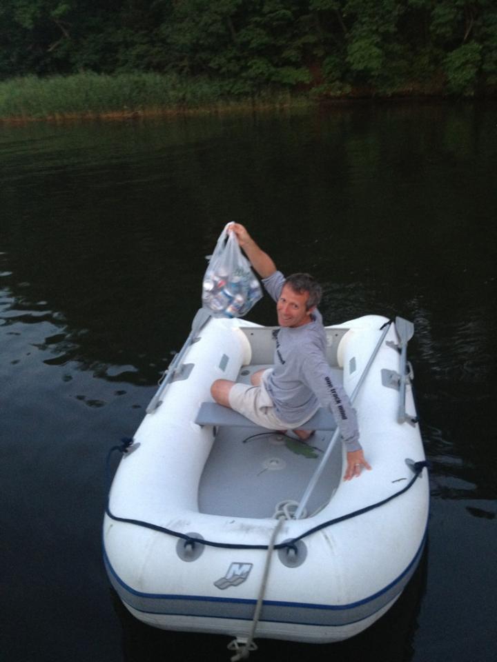
We set out at the very end of March to hike the Iron Mountain Trail. I streamlined the hiking crew to just one companion since it can get unwieldy to even plan a trip with the varying factors and influence of four or more people.

My friend Viking and I planned to hike this trail end-to-end. It has two distinct segments. One section is south of Damascus (about 19 miles long), and one section north of town (about 23 miles long). We planned to hike these two chucks in two trips rather than one because of work obligations.

As the date approached for our hike we arranged a rendezvous time to meet at Mt. Rogers Outfitter where a shuttle that Viking arranged would take us to the Iron Mountain trailhead.   

I excitedly packed in the days leading up to my trip. My packed pack sat ready and waiting (an unusual occurrence) in the living room. The hike was also a shakedown hike of a new-to-me old school Kelty pack I bought at Second Gear earlier in the month. I got it for 35 bucks and it seemed like a worthy investment in a relatively lightweight, yet sturdy, backpack.

I left later than I had planned, but I was still on time to reach Damascus. I was a few minutes late to meet Viking because of a stop at the grocery store for the washroom, cheese and pepperoni. I bought a compressed fuel canister for my beloved primus stove at Mount Rogers Outfitters and we crossed the street to our cars where we laced up our hiking boots and made our final gear decisions.

The shuttle ran us about $22 each. It’s no wonder! We took the gas guzzling 18-passenger van up the very curvy road. We talked a bit of trail and ramps with Damascus Dave. We got to the trailhead and got out to unload; Viking pointed out to me that this wasn’t exactly where we wanted to be. I was still getting my bearings, but it slowly sank in that we weren’t where we wanted to be. Out of courtesy or bewilderment, or both, neither Viking nor I advocated to be taken to our intended destination for the start of our hike. Dave said his adieus and drove away.

Viking and I deliberated. We could get on the Appalachian Trail here and hike the 2 miles to reach the Iron Mountain Trail (IMT), but doing so would mean missing a few miles of the IMT. Neither of us wanted to compromise a true end-to-ender by missing several miles, so being dedicated (or bullheaded) hikers we turned on to the road and walked through the horse camp I remembered from my A.T. hike. Then it seemed remote.  This day, the road seemed much more developed then it did during my A.T. hike, probably due to the context of arriving by four wheels.

At the far edge of the horse camp Viking and I stopped and deliberated again. Here we could take the Highland Horse Trail, another intersecting side trail, to reach the IMT. Again, we decided against it and walked on. Intermittently, cars passed. We thumbed, but none stopped. We sufficed to tell each other stories and invest our town-filled energy into the road walk.
It was a pretty road walk, as far as road walks go.

After a couple of miles a guy in a truck pulled over and let us hop in the back of his pickup. He took us to the Troutdale intersection where he would turn right to go home. We needed a ride to the left, several miles to where the road crests the ridge.
The land the road runs through is US Forest Service property.

While we stood thanking him for his generosity another man pulled up in his truck. He owned, we learned, the building where we stood – Jerry’s Kitchen. He said he had just closed it a week before, and he regretted not being able to offer us something. We assuaged his worries, letting him know that being fresh from town we were in need of nothing at all but a ride. This, he obliged us.


Happy to grab a hitch.

We sat in the bed of Jerry’s truck as it roared up the ascent of the ridge. It crested then began its descent. We missed our mark again. I told Viking “we just missed our road.” He extracted his map from the top pocket of his pack without losing a singular item to the intense wind we braced ourselves against and confirmed my theory. He knocked on the cab window, and our driver pulled off to a road on the left – Dickey Gap.

Jerry had understood that we wanted to return to the A.T. at Dickey Gap. There was no convincing him that we actually wanted to be left at the top of the ridge, so we contented ourselves with this destination. We thanked Jerry heartily for the ride as two forlorn looking women with large backpacks approached him for a ride into Troutdale.

Viking and I consulted our maps and decided that we had a few options from here. We could either road walk the half-mile back on the narrow-shouldered winding road to the top of the ridge, or walk the A.T. a bit and bushwhack up to the top of the ridge to connect with the IMT.

We chose the latter. We walked a half mile or so on the A.T. then took a line up the mountain to the top of the ridge, slipping on leaves, stepping over downed trees and branches, weaving between rhododendron, and pausing regularly to catch a breath.

Upon reaching the crest of the ridge it felt like we were on a very overgrown trail, thick with laurel and rhododendron. A sinking feeling hit the both of us, suspect of the trail we had just signed on to hike. Ahead there was a break in the trees, we pushed through the trail on which we stood to plant ourselves on a gravel road, the one Jerry had missed at the top of the mountain. We walked it back to its junction with Va. 16. There was no sign for the IMT, yet our maps showed it. Certainly we had been on it before, but it was overgrown. We decided to walk the road until the trail and road reconnected a bit further down. We met that intersection, where heaps of garbage littered the ground and faint yellow blazes indicated the IMT.

I whined for the need to refuel my body. We sat near the heaps of garbage in the road and ate a snack. Before long two pickup trucks drove past, sitting low with a large loads of firewood. The young man in the first truck knew nothing about trails. The second driver, a man with deeply weathered skin, laden with an aura of lingering cigarette smoke and whiskey, verified in his thick drawl that there was trailhead further along the road for Comers Creek Waterfall. We chose the road over the trail matted with detritus and overgrowth.

Comers Creek Trailhead
Just around the bend a ways we met the trailhead for Comer Creek Waterfall and the IMT. We took the blue blaze all the way to the A.T. and to the waterfall. We took photos. I marveled at how this wonder probably seemed like an every day occurrence to me when I hiked the A.T. in 2003.

Comers Creek Waterfall

We retraced our steps to the junction with the IMT and finally started on the actual trail at or after 3 p.m. – nearly four hours since we left Damascus.

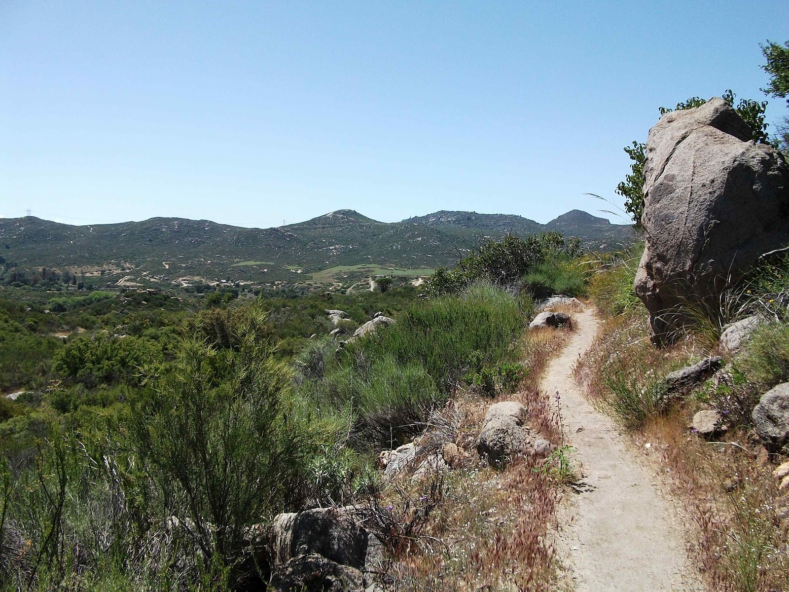
We climbed along the ridge. From here the trail was well maintained, open. My mind started to relax into that easy place it goes when I walk on a path four-feet wide and eight feet tall, carved through the trees, along ridges and beside streams. As I crossed a style into a pasture, I saw a turkey. Then it saw me and took flight in that labored way they tend look as they take off – like they won’t last long in the air before touching down again, just out of sight.

Turkey Sighting Central

The trail passed right back out of that same pasture over another cow style, as if the sole purpose for passing through was the brief touch with turkey. Into the woods we walked again. Then it opened up again to high balds being reclaimed again by woods. We walked along the open ridge for quite a while, gazing at the Balsam Range that includes the Grayson Highlands, Mount Rogers, and the Appalachian Trail. 

The Appalachian Trail used to follow this this path on this ridge, but it was relocated near Mt Rogers, the highest point in Virginia, and through scenic Grayson Highlands State Park in 1972. The Iron Mountain is now a multi-modal trail open to hikers, cyclists, and horses. I saw evidence of four-wheelers and some motorbikes, and I’m confused as to whether these are permissible uses throughout the length of the trail or only on certain sections, or completely restricted.

Within the first two miles or three miles, we had walked sections that it seemed only hikers could feasibly pass through, we walked narrow corridors, climbed over a few fallen trees, and easily navigated at least one poorly marked junction.

By the time our path reached the intersection with the Highlands Horse Trail it was wide and worn. It was rocky and I imagined that water flowed in the channel that was the trail during heavy rains.  Soon, we reached the junction with the Appalachian Trail. It was dusk and a couple we presumed to be A.T. hikers were setting up camp a couple hundred yards away. They ignored us as we deliberated briefly on how much farther we would walk.

We walked another quarter or half mile to reach Hurricane Mountain Trail and some reasonable ground for setting up camp. We considered pushing on to reach the shelter, then decided to stay. I think it was a good choice. Not long after making our decision, the drizzle set in and the clouds moved in low to blanket us for an Appalachian’s night sleep.

We talked for a while, Viking at the tree by his tent, me at the door of mine, as we ate dinner before retreating inside our respective homes.

I tried to rouse us at dawn, but that didn’t work. Between us we didn’t have a watch, but I think I was on trail by 8. I walked the mile to the Cherry Tree Shelter with Viking bringing up the rear. Situated in a clearing, it was still shrouded in the morning mist and gave me deep gratitude for the extra quiet I feel when there’s fog. It always gives mornings more solemnity.

Cherry Gap Shelter
I hadn’t eaten breakfast yet. I was waiting to sit under the eves of the shelter, make a hot coffee with my Via, and drink in the morning as I ate my Lara Bar. We got water from the stacked stone box that held the spring water using Viking’s water filter. I toyed with the idea of flipping some rocks or digging through the mud in the stream downhill from the spring in an effort to spot and photograph crayfish, but I felt too cold to worry with it.

It was breezy. I pulled on my wool neck warmer, donned my fleece, and fired up my stove. We lingered a long time here, instigated entirely by me. I felt really happy at the shelter. We talked about all kinds of things, but I distinctly remember talking about the PCT. I had recently met with a friend of a friend who wanted advice for her upcoming PCT hike. I shared what advice I had to offer, which hasn’t changed much since my post PCTmusings on the matter. My conversation with her invigorated me for the trail. I was longing for it while I talked to Viking. (Apparently my longing was contagious. He put notice in for his work shortly after our hike and started his PCT hike earlier this month.)

We departed well after an hour, maybe closer to two, after eating breakfast, drinking two cups of coffee, and having copious amounts of trail talk.

Viking set off down the trail before me. I had a couple things to wrap up. Even after I had closed the gap, when he was within sight distance, I lagged behind relishing what quiet morning hiking does for clearing my head. I observed how moss really gets its “pop” when it’s foggy. Unlike everything else that seems muted by the opaque atmosphere, moss on rocks seems more vibrant green.

Morning Walk
The trail was wide, located on an old roadbed. Four wheelers or trucks had churned the trail in this section, leaving their muddy tracks. When we got to the junction with a gravel forest service road I discovered why. The barricades intended to keep vehicles out had been removed. Signs for the trail had been shot or otherwise mutilated into oblivion. Garbage at the trail junction was abundant there and for the next quarter mile along the forest service road we walked. We stayed on it for about a mile total, walking abreast and talking.

Trail damaged by vehicles.

The following ten miles we walked independently. Viking steamed ahead. I walked tenderly through the forest sensitive about its delicate nature. I smelled the vile scent of decay of what I presume was wildlife road kill at Va 600, and not far a junction with Skulls Gap Trail I picked my way through part of the trail desiccated by motorbikes as it ascended beside a stream.

Iron Mountain Trail at Skulls Gap

I walked through a too small field. I wanted it to be bigger, and expansive. It ended suddenly returning me to the woods before I encountered Viking again at the Straight Branch Shelter.

I excitedly prepared the meal I wanted to cook the night before, but a hot meal had been waylaid by the rain. I carried dehydrated refried beans to which I added cumin and a little spice powder from a packet intended for salsa verde. I had salsa in a bag. I had an avocado, cheese, and pepperoni. This I rolled up in tortillas for some satisfyingly delicious lunch. It’s easy to become complacent when planning backpacking meals, so when I have an elaborately envisioned meal, just like at home, it makes it that much more appreciated. Unless it sucks. But this one did not suck. It was good!

There were five miles between lunch and the third and final shelter before reaching Damascus. We originally intended to stay at Sandy Flats Shelter, but discussed at lunch pushing the final five miles into Damascus instead of staying another night in the woods.

I left the decision in Viking’s court. We had already been hiking hard though the trail had been relatively easy. I felt like I could certainly do another ten miles; it didn’t seem as though we had already hiked seven.

Viking set out. I brought up the rear. I stopped and wrote in my journal along the way, and I didn’t see him again for the next file miles. I saw two mountain bikers and heard the peal of motorbikes on an intersecting trail I had just crossed. Then I heard the mountain bikers exchanging words with the motorcyclists; in my imagination the exchange was confrontational, maybe because it began with shouting over the motors. I was glad to have avoided the motorbikes altogether. As it was they had been a loud intrusion into my quiet walk.

As I approached Sandy Flats Shelter it started to rain. Then thunder and lightning began. An eagle scout, his two friends, father, and grandfather were working on the privy behind the shelter. Remarkably, they continued working to finish the project despite the storm. They were elated to add the throne itself as the final touch to their masterpiece. Having built a mouldering privy with HardCore once, I could empathize with the sense of satisfaction. It’s a bigger project that you first imagine.

While the rain thrashed the roof of the shelter, Viking and I talked earnestly about friendships, past relationships, and the pros and cons of continuing the final five miles to Damascus that afternoon. We had gathered from the scouts that it was already 4:30 and we expected nightfall by 7:30. We could make it, if we left soon.

While I preferred staying in the woods another night (why wouldn’t I), I was heartened to hike on when I found my headlamp. I had to unpack my sleeping bag to find it, but I FOUND it! It’s the simple things that are so important in the woods.

We decided once and for all to make a push for Damascus. We set off. I, in the lead, pushing hard. The trail steadily ascended a ridge. About a mile or mile and a half into the climb, I reached a switchback and big, heavy raindrops started plopping on me. I ripped my pack off in the quickening wind and unzipped the external pocked that held my rain poncho. I put my pack back on and draped the poncho over me and my pack. I hadn’t used my rain poncho on a backpacking trip, ever. It seemed that this gully washer was going to offer a good test run.

I hustled down the trail. The rain bullets and wind subsided. Renewed with hope, and overheating, I slid the hood off my head. I kept my quick pace to out-walk the inevitable storm as much as possible.

The wind swept up the ridge again, and again subsided. When the wind hit my face I looked up to the dark and ominous skies pushing toward me.

The rain started. Head down, hiking hard. My poncho was less than perfect. Rain soaked my skirt. Rain soaked my shirt. A stiff fold in it channeled water onto me rather than away from me. I mentally wrote off using the poncho again on a future hike; this is an important milestone for any piece of hiking gear.

The junction with the side trail to the A.T. gave me momentary pause. It would be the longer walk to town, per the guidebook, though it was a more agreeable hike. The route ahead on the IMT would be a difficult, rocky, and steep descent, but it would be shorter. We forged ahead on the IMT.

With Damascus two miles ahead, the storm hit with furry. Rain, rain, lots of rain. This trail, heavily used by mountain bikes, is routed clean of topsoil by fast moving water, exposing lots of rocks to stumble on and over.  Lightening frequently illuminated the forests nearby punctuated by the immediate claps of thunder.  The wind rose again. Then, the unexpected, hail. Buckets of hail. The dime sized ice pellets thwacked my head, shoulders, and arms. When they struck my exposed hands and forearms it stung. I was grateful for my poncho again. Now it was the buffer between me and the ice slingshot from the sky. I imaged my skin marked by polka-dot bruises as I careened down the trail, feeling exhilarated by the rush of adrenaline. Between lightening, thunder, wind, hail, and approaching nightfall I screeched with laughter. This was too much. It was unbelievable. It was terrible and wonderful. The soaked red clay was being covered over by white, and the forest again shifted to my sight into something completely different.

Viking was ahead, moving fast. I couldn’t keep up with him. I picked my way as carefully as I could through the rocky trail. I cautiously chose my steps to protect my left ankle from a haphazard step that would turn it and leave me writhing in the mud. I was bemused by how fast I was able to move despite my caution, but Viking frequently vanished out of sight.

The hail let up for a while. Then it started again as the trail leveled by a stream. Then the trail became the stream. We walked through ankle deep water, sloshing through, not around, water because, like I learned in 2003, at some point there is no way to regain being dry. Each step oozes some water out of your boot while fresh water oozes back in to replace it.

We were euphoric to reach the blacktop of the road that would lead us a to town. It wasn’t far, but we were more exposed. It was still hailing, and there were no trees to take some of the fall for us. It was just us, the asphalt, and Mother Nature.

People in town were like ants in a rain storm, except they were in their cars, driving around seeking protected shelter to keep the cars’ finish from getting banged up by the hail, seeking the metaphorical higher ground. It was comical to my mind that here we were, exposed to the elements, wet, and walking through puddles inside our own boots. We should have been uncomfortable, seeking higher ground, banging on doors to be taken in by someone, eating pizza, but it seemed entirely normal this way. I felt satisfied with my 17 miles this day, the 2 by road and 3 by trail we walked the day before.

Buoyant, I felt my spirit clean and renewed, after just two short days on the IMT.

As I narrowed in on my car, I recalled another conversation I had with Viking at Cherry Tree Shelter. It was about the expression, “the trail gives you what you need,” and I thought, “and so it has.”

I haven’t hiked the second portion yet. When I do, I’ll be sure to tell you all about it.


Trail Maps and Guides that Viking and I used on this trip: 
  • Mount Rogers National Geographic map,
  • Map 1 of the A.T. Map pack for the Virginia George Washington/Jefferson National Forest, and
  • Appalachian Trail Conservancy's Southwest Virginia guidebook.