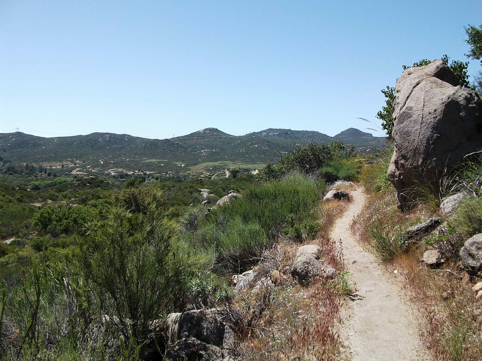
It’s the day before the Republican primary elections here in North Carolina. I’ll be voting. It’s one way for me to voice my opinion, and I hope this letter is one of many more you will receive from me.
This letter is to urge you to vote against National Security and Federal Lands Protect Act (H.R. 1505). It will do nothing but harm to some of our Nation’s most amazing places. Furthermore, my personal experience is evidence that there is already an adequate density of border agents, their vigilant presence, and influence in the vicinity of our borders. This is my experience.
Two years ago, on May 1, I was driven from San Diego to a monument a stone’s throw from the wall of the Mexican border near Campo, California. I was starting a 1,200-mile hike of America’s Congressionally protected Pacific Crest National Scenic Trail. Comparable to its well-known eastern counterpart, the Appalachian Trail, the Pacific Crest Trail is even longer and more majestic than the A.T. – running border to border, 2,600 miles – Mexico to Canada. It’s a line that literally connects our country, its beauty, history, and people.
Trust me, there is plenty of border patrol activity in Southern California already without the providing them with additional control. As I stood at the monument that morning, I looked back at the wall that bisected the land on which I stood; between where I stood and the wall, the sand had been smoothed flat – a first step in Border Patrol tracking footprints, here and along the rest of the border.
For the next several days of walking, the next seventy to a hundred miles, I was watched, constantly. Being a backpacker, I’m comfortable going to the bathroom in the wilderness. What I found a bit unsettling is that despite my vigilance to ensure my privacy while doing so (look, look, look, “yep, it’s all clear”) I would inevitably finish my business, walk several more paces and then see the border patrol agents. They are everywhere! The border patrol is not want of manpower, supplies, or “control” within the current structure, and I’m fearful of the degradation of this Trail and other National Parks, Wilderness areas, and National Forests if H.R. 1505 is passed.
Hiking brings me joy. Like a modern day John Muir, if I may be so bold, the connection I feel with nature when walking in the woods leaves me feeling more free, more happy, more kind, more appreciative, and more connected to every last minutia of life on this land.
If this bill advanced into law, it would be a blow to the predecessors who established these National Parks, National Scenic Trails, and National Forests that are purposefully designed to be scenic, remote, protected, and secured from unnecessary development or degradation.
It would also threaten the freedom those of us who enjoy time spent outdoors feel when we hike.
I invite you to come hike with me. Yes, you.
We’ll go walk from the border at Campo along the Pacific Crest Trail, if you like. We’ll hike, observe the border agents’ command of the territory already, and see amazing beauty. Come on, one week. Let’s go!
Or, we will walk the Southern Appalachian Highlands, near my home in Western N.C. Either way, I want to share with you what makes these special places, special. How will you know if you don’t walk them, too?
Every hike is an offering to the time we have on this precious planet. You have the opportunity to make your offering when this bill comes up for a vote. Please, for the love of nature, do what is right and good for our parks and wild places by voting against H.R. 1505.
Let’s continue to experience these trails, parks, and forests, now and in the future, in the ways they were intended – free, open, beautiful – America.
Sincerely,
Leanna Joyner
----------------------------------------------------
I sent this letter to:
Rep. Heath Shuler
Sen. Richard Burr
Sen. Kay Hagan
President Barack Obama
* I made context changes to request a veto of this bill should it advance to President Obama to become law. I am mailing his letter today since the email function of the White House website prohibitively limits the length of a message.
-------------------------------------------------------
Learn more about this bill here: http://wilderness.org/content/border-patrol-takeover-act
Monday, May 7, 2012
Saturday, May 5, 2012
Mother's Day
I wish I could unsubscribe to all the email reminders from
merchandisers about Mother's Day. It doesn’t apply to me one iota any more. I
don’t have grandmothers or a mother.
Not living, anyway.
But my mother’s presence is heavy in the air today, as it was
last night. My sister is in the woods singing to her, and all of us children
are the beneficiaries.
Last night as I was going to sleep, under the almost-full
moon, I had a flash of a memory. I pulled on the familiar tale, drawing it out
again, as I have so many times before. The story is of a t-shirt, one of my
mother’s many gifts to me.
I cherish it because it represents a truth about me, but I
cherish it more for the words she spoke to me as I held it aloft to examine it.
It made me special then, as it does now.
Mommy and Daddy returned from a rare trip away from us kids;
they had the opportunity to travel to Alaska, thanks to my mother’s parents. While
my parent’s cruised Glacier Bay, my dad’s parents came to stay with us for the
week. I was probably 11; Tracy,
16; Ian, 4.
We gathered around them when they got home, basking in
Mommy’s radiant love and hearing stories of what it was like of the far side of
our country. They dispensed the requisite gifts that travel bestows, and we
gathered closer to open and ogle the thoughtfully considered gifts we each
received.
When she gave me this shirt she said, “I brought you this because of any of my children you will do something like this.” I’ve remembered this time and time again throughout my life.
Sometimes I wonder if I would have ever had the courage to
take any of the travels I’ve made if it weren’t for my mother offering such
empowering words to me and handing me a symbol of strength to which I could
cling. I have, during many challenges, remembered this shirt, and said to
myself “of any of my mother’s children, I will…”
Other times, I feel like her motherly knowing –of knowing me
to my absolute, pure essence allowed her to purchase just the thing that
captured what she knew to be true about my spirit – and convey it “you will do
something like this.”
Friday, May 4, 2012
Iron Mountain Trail
Trail Details: The total length of the trail from its
beginning at Cross Mountain in Tennessee to its northern terminus at Virginia
Route 16, near Troutville, Virginia is 42 miles. It’s segmented almost in half
by the trail friendly town of Damascus. This makes an ideal point of resupply
for a complete end-to-end hike, or the perfect spot to segment the hike as part
of a section hike for weekenders.
We set out at the very end of March to hike the Iron
Mountain Trail. I streamlined the hiking crew to just one companion since it
can get unwieldy to even plan a trip with the varying factors and influence of
four or more people.
My friend Viking and I planned to hike this trail end-to-end.
It has two distinct segments. One section is south of Damascus (about 19 miles
long), and one section north of town (about 23 miles long). We planned to hike
these two chucks in two trips rather than one because of work obligations.
As the date approached for our hike we arranged a rendezvous
time to meet at Mt. Rogers Outfitter where a shuttle that Viking arranged would
take us to the Iron Mountain trailhead.
I excitedly packed in the days leading up to my trip. My
packed pack sat ready and waiting (an unusual occurrence) in the living room.
The hike was also a shakedown hike of a new-to-me old school Kelty pack I
bought at Second Gear earlier in the month. I got it for 35 bucks and it seemed
like a worthy investment in a relatively lightweight, yet sturdy, backpack.
I left later than I had planned, but I was still on time to
reach Damascus. I was a few minutes late to meet Viking because of a stop at
the grocery store for the washroom, cheese and pepperoni. I bought a compressed
fuel canister for my beloved primus stove at Mount Rogers Outfitters and we
crossed the street to our cars where we laced up our hiking boots and made our
final gear decisions.
The shuttle ran us about $22 each. It’s no wonder! We took
the gas guzzling 18-passenger van up the very curvy road. We talked a bit of
trail and ramps with Damascus Dave. We got to the trailhead and got out to
unload; Viking pointed out to me that this wasn’t exactly where we wanted to
be. I was still getting my bearings, but it slowly sank in that we weren’t
where we wanted to be. Out of courtesy or bewilderment, or both, neither Viking
nor I advocated to be taken to our intended destination for the start of our
hike. Dave said his adieus and drove away.
Viking and I deliberated. We could get on the Appalachian
Trail here and hike the 2 miles to reach the Iron Mountain Trail (IMT), but
doing so would mean missing a few miles of the IMT. Neither of us wanted to
compromise a true end-to-ender by missing several miles, so being dedicated (or
bullheaded) hikers we turned on to the road and walked through the horse camp I
remembered from my A.T. hike. Then it seemed remote. This day, the road seemed much more developed then it did
during my A.T. hike, probably due to the context of arriving by four wheels.
At the far edge of the horse camp Viking and I stopped and deliberated again. Here we could take the Highland Horse Trail, another intersecting side trail, to reach the IMT. Again, we decided against it and walked on. Intermittently, cars passed. We thumbed, but none stopped. We sufficed to tell each other stories and invest our town-filled energy into the road walk.
After a couple of miles a guy in a truck pulled over and let
us hop in the back of his pickup. He took us to the Troutdale intersection
where he would turn right to go home. We needed a ride to the left, several
miles to where the road crests the ridge.
While we stood thanking him for his generosity another man pulled
up in his truck. He owned, we learned, the building where we stood – Jerry’s
Kitchen. He said he had just closed it a week before, and he regretted not
being able to offer us something. We assuaged his worries, letting him know
that being fresh from town we were in need of nothing at all but a ride. This,
he obliged us.
We sat in the bed of Jerry’s truck as it roared up the
ascent of the ridge. It crested then began its descent. We missed our mark
again. I told Viking “we just missed our road.” He extracted his map from the
top pocket of his pack without losing a singular item to the intense wind we
braced ourselves against and confirmed my theory. He knocked on the cab window,
and our driver pulled off to a road on the left – Dickey Gap.
Jerry had understood that we wanted to return to the A.T. at
Dickey Gap. There was no convincing him that we actually wanted to be left at
the top of the ridge, so we contented ourselves with this destination. We
thanked Jerry heartily for the ride as two forlorn looking women with large
backpacks approached him for a ride into Troutdale.
Viking and I consulted our maps and decided that we had a
few options from here. We could either road walk the half-mile back on the
narrow-shouldered winding road to the top of the ridge, or walk the A.T. a bit
and bushwhack up to the top of the ridge to connect with the IMT.
We chose the latter. We walked a half mile or so on the A.T.
then took a line up the mountain to the top of the ridge, slipping on leaves, stepping
over downed trees and branches, weaving between rhododendron, and pausing
regularly to catch a breath.
Upon reaching the crest of the ridge it felt like we were on
a very overgrown trail, thick with laurel and rhododendron. A sinking feeling
hit the both of us, suspect of the trail we had just signed on to hike. Ahead
there was a break in the trees, we pushed through the trail on which we stood
to plant ourselves on a gravel road, the one Jerry had missed at the top of the
mountain. We walked it back to its junction with Va. 16. There was no sign for
the IMT, yet our maps showed it. Certainly we had been on it before, but it was
overgrown. We decided to walk the road until the trail and road reconnected a
bit further down. We met that intersection, where heaps of garbage littered the
ground and faint yellow blazes indicated the IMT.
I whined for the need to refuel my body. We sat near the
heaps of garbage in the road and ate a snack. Before long two pickup trucks
drove past, sitting low with a large loads of firewood. The young man in the
first truck knew nothing about trails. The second driver, a man with deeply
weathered skin, laden with an aura of lingering cigarette smoke and whiskey,
verified in his thick drawl that there was trailhead further along the road for
Comers Creek Waterfall. We chose the road over the trail matted with detritus
and overgrowth.
![]() |
| Comers Creek Trailhead |
Just around the bend a ways we met the trailhead for Comer
Creek Waterfall and the IMT. We took the blue blaze all the way to the A.T. and
to the waterfall. We took photos. I marveled at how this wonder probably seemed
like an every day occurrence to me when I hiked the A.T. in 2003.
![]() |
| Comers Creek Waterfall |
We retraced our steps to the junction with the IMT and finally started on the actual trail at or after 3 p.m. – nearly four hours since we left Damascus.
We climbed along the ridge. From here the trail was well
maintained, open. My mind started to relax into that easy place it goes when I
walk on a path four-feet wide and eight feet tall, carved through the trees,
along ridges and beside streams. As I crossed a style into a pasture, I saw a
turkey. Then it saw me and took flight in that labored way they tend look as
they take off – like they won’t last long in the air before touching down
again, just out of sight.
![]() |
| Turkey Sighting Central |
The trail passed right back out of that same pasture over
another cow style, as if the sole purpose for passing through was the brief
touch with turkey. Into the woods we walked again. Then it opened up again to
high balds being reclaimed again by woods. We walked along the open
ridge for quite a while, gazing at the Balsam Range that includes the Grayson Highlands, Mount Rogers, and the Appalachian Trail.
The Appalachian Trail used to follow this this path on this ridge, but it was
relocated near Mt Rogers, the highest point in Virginia, and through scenic Grayson Highlands State Park in 1972. The Iron
Mountain is now a multi-modal trail open to hikers, cyclists, and horses. I
saw evidence of four-wheelers and some motorbikes, and I’m confused as to
whether these are permissible uses throughout the length of the trail or only
on certain sections, or completely restricted.
Within the first two miles or three miles, we had walked
sections that it seemed only hikers could feasibly pass through, we walked
narrow corridors, climbed over a few fallen trees, and easily navigated at
least one poorly marked junction.
By the time our path reached the intersection with the
Highlands Horse Trail it was wide and worn. It was rocky and I imagined that
water flowed in the channel that was the trail during heavy rains. Soon, we reached the junction with the
Appalachian Trail. It was dusk and a couple we presumed to be A.T. hikers were
setting up camp a couple hundred yards away. They ignored us as we deliberated
briefly on how much farther we would walk.
We walked another quarter or half mile to reach Hurricane Mountain Trail and some
reasonable ground for setting up camp. We considered pushing on to reach the
shelter, then decided to stay. I think it was a good choice. Not long after
making our decision, the drizzle set in and the clouds moved in low to blanket
us for an Appalachian’s night sleep.
We talked for a while, Viking at the tree by his tent, me at
the door of mine, as we ate dinner before retreating inside our respective
homes.
I tried to rouse us at dawn, but that didn’t work. Between
us we didn’t have a watch, but I think I was on trail by 8. I walked the mile
to the Cherry Tree Shelter with Viking bringing up the rear. Situated in a
clearing, it was still shrouded in the morning mist and gave me deep gratitude
for the extra quiet I feel when there’s fog. It always gives mornings more
solemnity.
![]() |
| Cherry Gap Shelter |
I hadn’t eaten breakfast yet. I was waiting to sit under the
eves of the shelter, make a hot coffee with my Via, and drink in the morning as
I ate my Lara Bar. We got water from the stacked stone box that held the spring
water using Viking’s water filter. I toyed with the idea of flipping some rocks
or digging through the mud in the stream downhill from the spring in an effort
to spot and photograph crayfish, but I felt too cold to worry with it.
It was breezy. I pulled on my wool neck warmer, donned my
fleece, and fired up my stove. We lingered a long time here, instigated
entirely by me. I felt really happy at the shelter. We talked about all kinds
of things, but I distinctly remember talking about the PCT. I had recently met
with a friend of a friend who wanted advice for her upcoming PCT hike. I shared
what advice I had to offer, which hasn’t changed much since my post PCTmusings on the matter. My conversation with her invigorated me for the
trail. I was longing for it while I talked to Viking. (Apparently my longing
was contagious. He put notice in for his work shortly after our hike and started
his PCT hike earlier this month.)
We departed well after an hour, maybe closer to two, after
eating breakfast, drinking two cups of coffee, and having copious amounts of
trail talk.
Viking set off down the trail before me. I had a couple
things to wrap up. Even after I had closed the gap, when he was within sight
distance, I lagged behind relishing what quiet morning hiking does for clearing
my head. I observed how moss really gets its “pop” when it’s foggy. Unlike everything
else that seems muted by the opaque atmosphere, moss on rocks seems more
vibrant green.
![]() |
| Morning Walk |
The trail was wide, located on an old roadbed. Four wheelers
or trucks had churned the trail in this section, leaving their muddy tracks.
When we got to the junction with a gravel forest service road I discovered why.
The barricades intended to keep vehicles out had been removed. Signs for the
trail had been shot or otherwise mutilated into oblivion. Garbage at the trail
junction was abundant there and for the next quarter mile along the forest
service road we walked. We stayed on it for about a mile total, walking abreast
and talking.
![]() |
| Trail damaged by vehicles. |
The following ten miles we walked independently. Viking
steamed ahead. I walked tenderly through the forest sensitive about its delicate
nature. I smelled the vile scent of decay of what I presume was wildlife road
kill at Va 600, and not far a junction with Skulls Gap Trail I picked my way through part of the
trail desiccated by motorbikes as it ascended beside a stream.
I walked through a too small field. I wanted it to be
bigger, and expansive. It ended suddenly returning me to the woods before I
encountered Viking again at the Straight Branch Shelter.
I excitedly prepared the meal I wanted to cook the night
before, but a hot meal had been waylaid by the rain. I carried dehydrated refried beans to which I added
cumin and a little spice powder from a packet intended for salsa verde. I had
salsa in a bag. I had an avocado, cheese, and pepperoni. This I rolled up in
tortillas for some satisfyingly delicious lunch. It’s easy to become complacent
when planning backpacking meals, so when I have an elaborately envisioned meal,
just like at home, it makes it that much more appreciated. Unless it sucks. But
this one did not suck. It was good!
There were five miles between lunch and the third and final
shelter before reaching Damascus. We originally intended to stay at Sandy Flats
Shelter, but discussed at lunch pushing the final five miles into Damascus
instead of staying another night in the woods.
I left the decision in Viking’s court. We had already been
hiking hard though the trail had been relatively easy. I felt like I could
certainly do another ten miles; it didn’t seem as though we had already hiked
seven.
Viking set out. I brought up the rear. I stopped and wrote
in my journal along the way, and I didn’t see him again for the next file
miles. I saw two mountain bikers and heard the peal of motorbikes on an
intersecting trail I had just crossed. Then I heard the mountain bikers exchanging
words with the motorcyclists; in my imagination the exchange was
confrontational, maybe because it began with shouting over the motors. I was
glad to have avoided the motorbikes altogether. As it was they had been a loud
intrusion into my quiet walk.
As I approached Sandy Flats Shelter it started to rain. Then thunder
and lightning began. An eagle scout, his two friends, father, and grandfather
were working on the privy behind the shelter. Remarkably, they continued
working to finish the project despite the storm. They were elated to add the
throne itself as the final touch to their masterpiece. Having built a
mouldering privy with HardCore once, I could empathize with the sense of
satisfaction. It’s a bigger project that you first imagine.
While the rain thrashed the roof of the shelter, Viking and
I talked earnestly about friendships, past relationships, and the pros and cons
of continuing the final five miles to Damascus that afternoon. We had gathered
from the scouts that it was already 4:30 and we expected nightfall by 7:30. We
could make it, if we left soon.
While I preferred staying in the woods another night (why
wouldn’t I), I was heartened to hike on when I found my headlamp. I had to
unpack my sleeping bag to find it, but I FOUND it! It’s the simple things that
are so important in the woods.
We decided once and for all to make a push for Damascus. We
set off. I, in the lead, pushing hard. The trail steadily ascended a ridge.
About a mile or mile and a half into the climb, I reached a switchback and
big, heavy raindrops started plopping on me. I ripped my pack off in the
quickening wind and unzipped the external pocked that held my rain poncho. I
put my pack back on and draped the poncho over me and my pack. I hadn’t used my
rain poncho on a backpacking trip, ever. It seemed that this gully washer was
going to offer a good test run.
I hustled down the trail. The rain bullets and wind
subsided. Renewed with hope, and overheating, I slid the hood off my head. I
kept my quick pace to out-walk the inevitable storm as much as possible.
The wind swept up the ridge again, and again subsided. When
the wind hit my face I looked up to the dark and ominous skies pushing toward
me.
The rain started. Head down, hiking hard. My poncho was less
than perfect. Rain soaked my skirt. Rain soaked my shirt. A stiff fold in it
channeled water onto me rather than away from me. I mentally wrote off using
the poncho again on a future hike; this is an important milestone for any piece
of hiking gear.
The junction with the side trail to the A.T. gave me
momentary pause. It would be the longer walk to town, per the guidebook, though
it was a more agreeable hike. The route ahead on the IMT would be a difficult,
rocky, and steep descent, but it would be shorter. We forged ahead on the IMT.
With Damascus two miles ahead, the storm hit with furry.
Rain, rain, lots of rain. This trail, heavily used by mountain bikes, is routed
clean of topsoil by fast moving water, exposing lots of rocks to stumble on and
over. Lightening frequently
illuminated the forests nearby punctuated by the immediate claps of
thunder. The wind rose again.
Then, the unexpected, hail. Buckets of hail. The dime sized ice pellets
thwacked my head, shoulders, and arms. When they struck my exposed hands and
forearms it stung. I was grateful for my poncho again. Now it was the buffer between
me and the ice slingshot from the sky. I imaged my skin marked by polka-dot
bruises as I careened down the trail, feeling exhilarated by the rush of
adrenaline. Between lightening, thunder, wind, hail, and approaching nightfall
I screeched with laughter. This was too much. It was unbelievable. It was
terrible and wonderful. The soaked red clay was being covered over by white,
and the forest again shifted to my sight into something completely different.
Viking was ahead, moving fast. I couldn’t keep up with him.
I picked my way as carefully as I could through the rocky trail. I cautiously
chose my steps to protect my left ankle from a haphazard step that would turn
it and leave me writhing in the mud. I was bemused by how fast I was able to
move despite my caution, but Viking frequently vanished out of sight.
The hail let up for a while. Then it started again as the
trail leveled by a stream. Then the trail became the stream. We walked through
ankle deep water, sloshing through, not around, water because, like I learned
in 2003, at some point there is no way to regain being dry. Each step oozes
some water out of your boot while fresh water oozes back in to replace it.
We were euphoric to reach the blacktop of the road that
would lead us a to town. It wasn’t far, but we were more exposed. It was still
hailing, and there were no trees to take some of the fall for us. It was just
us, the asphalt, and Mother Nature.
People in town were like ants in a rain storm, except they
were in their cars, driving around seeking protected shelter to keep the cars’
finish from getting banged up by the hail, seeking the metaphorical higher
ground. It was comical to my mind that here we were, exposed to the elements,
wet, and walking through puddles inside our own boots. We should have been
uncomfortable, seeking higher ground, banging on doors to be taken in by
someone, eating pizza, but it seemed entirely normal this way. I felt satisfied
with my 17 miles this day, the 2 by road and 3 by trail we walked the day
before.
Buoyant, I felt my spirit clean and renewed, after just two
short days on the IMT.
As I narrowed in on my car, I recalled another conversation I
had with Viking at Cherry Tree Shelter. It was about the expression, “the trail
gives you what you need,” and I thought, “and so it has.”
I haven’t hiked the second portion yet. When I do, I’ll be
sure to tell you all about it.
Trail Maps and Guides that Viking and I used on this trip:
- Mount Rogers National Geographic map,
- Map 1 of the A.T. Map pack for the Virginia George Washington/Jefferson National Forest, and
- Appalachian Trail Conservancy's Southwest Virginia guidebook.
Wednesday, May 2, 2012
Book Review: Wild
I just read Cheryl Strayed’s Wild about her three-month journey on the Pacific Crest Trail in 1995, what led her there, what kept her there, and the growth and healing found through her near thousand-mile walk.
It’s full of contradictions that mutually reside in us and around us. In this way we bear witness, along with Cheryl, to feelings of emptiness in a vast world, and the vastness felt in one devoid of excesses.
Cheryl captures the hardship, beauty, wonder, and guts of a long distance hike. She is brave. She is flawed. Best of all, she speaks authentically about all of it, stripping down the complexities of her life and her decisions so we can ache in her loss, feel nostalgia for relationships past, and understand her steadfastness in hiking alone.
I found myself thinking she repeats herself sometimes with some of the story's elements, but that is easily forgivable because of the intricate web she cast to lead us between life on the trail and life before the hike.
I gobbled this book up. I read half Friday afternoon and evening. I read the remainder on Sunday, but all Saturday I held the book in my hands as I visited with family, wishing for the time to step back on the trail with Cheryl to see where her adventure would take us next.
Before I opened the cover of Wild on Friday, I wrote in my journal about my confusion and despair about the day – of feeling overwhelmed with life’s purpose, creative vision, and too many competing business ideas.
I want to thank my hiking buddy Morph who brought me Wild as a gift when he came to visit last month. You’re right; I enjoyed it a lot!
It’s full of contradictions that mutually reside in us and around us. In this way we bear witness, along with Cheryl, to feelings of emptiness in a vast world, and the vastness felt in one devoid of excesses.
Cheryl captures the hardship, beauty, wonder, and guts of a long distance hike. She is brave. She is flawed. Best of all, she speaks authentically about all of it, stripping down the complexities of her life and her decisions so we can ache in her loss, feel nostalgia for relationships past, and understand her steadfastness in hiking alone.
I found myself thinking she repeats herself sometimes with some of the story's elements, but that is easily forgivable because of the intricate web she cast to lead us between life on the trail and life before the hike.
* * *
I gobbled this book up. I read half Friday afternoon and evening. I read the remainder on Sunday, but all Saturday I held the book in my hands as I visited with family, wishing for the time to step back on the trail with Cheryl to see where her adventure would take us next.
Before I opened the cover of Wild on Friday, I wrote in my journal about my confusion and despair about the day – of feeling overwhelmed with life’s purpose, creative vision, and too many competing business ideas.
"So I sit in this stew of discontent. Unable to decide if I should read a book on hiking that will either a) drive me out of my home and on a single-minded vision to hike the better part of this year b) make me compulsively wonder how I can start to write about my own backpacking pursuits, or c) send me spiraling into depression for the fear that I’ll never write my story nor have the fiscal resources to do that kind of travel this year."
I want to thank my hiking buddy Morph who brought me Wild as a gift when he came to visit last month. You’re right; I enjoyed it a lot!
Sunday, April 22, 2012
Book Review: Born to Run
It started with almost too much mystery. A hidden culture. A
mythical, ghost-like figure whose purpose was obscured. An anthropological
study of canyon-dwelling natives.
It took about 70 pages before the pace of the book picked up
and flowed. It’s almost like the first couple miles of any run, slightly
labored. Once I advanced beyond the entry point, the body of the Born to Run
opened up into a tale I couldn’t stop myself from following right through to
the author’s last word.
The essence I took from the book is that running can and
should be enjoyable. The characters, the best of them, run for no other reason than pleasure.
In reflecting on this truth, I recall that my most profound
periods of success with running have come when I use running as a salve for my
woes: as a way to relax after work, to jumpstart a weekend, to reconnect with
myself, or to commune with friends. I’m most content in my runs when it’s not
competitive, but a form of renewal.
I gathered this is how it started for some of the
ultra-marathoners featured in Born to Run. They didn’t set out to be awesome
distance runners. They ran for pleasure; their success was a side effect of the
elation felt in the run that carried them further and faster.
I think these same qualities apply with long hikes, too.
It’s the heart you put in it. When you find a love of life for and through the
movement, it feels like you can go on forever.
McDougall gives readers a fascinating look at the philosophy
and psychology of successful distance runners as much as the physiological
constructs of the human body built to run. The fundamentals come down to
building as much soul as strength, but the run-fast formula is laced throughout
the book in research studies, anecdotes, and practical applications.
It’s more than a how-to book to running. It’s a gripping
story of a amazing races, unforgiving terrain, kindhearted people, and a
dedication to something bigger.
After all, McDougall writes: “The reason we race isn’t so
much to beat each other but to be with each other.”
Friday, April 20, 2012
Down to Earth Diva: The Evolution of a Hiking Skirt
I haven’t done the math, but I’ve probably walked
4,000 miles in skirts. It started with my decision to hike in a skirt when I
hiked the A.T. in 2003.
| On the Pacific Crest Trail in 2010. |
About two months ago catalogs selling clothing for active
women started arriving. I suspect race directors for the Nashville Marathon
sold my name. Athleta and Title 9 have become regular circulars in my post
office box since then. I was flipping through them over lunch one day, scanning
pages for skirts with just the right details – synthetic fabric, pockets,
A-line, and without under-shorts. It turned into one of those moments when you
step outside yourself and observe the absurdity for a moment. Here I am, with
plenty of skirts for running, hiking, and playing in, yet seeking more.
While some might consider it an obsession, I consider it a
quest for the perfect skirt (then again, I’m always on a quest for the perfect
backpack, too). Regardless of the fixation that drives my compulsion to
purchase and try out every skirt made of wicking material (and they’re even
more common now that running skirts are on the rise (no pun intended, though
they do tend to be shorter that what I’d like for hiking).
I’ll go ahead and admit here that I like to feel like I look nice even if I’m sweating. I don’t have to wear Prada on the trail, but some semblance of matching makes me feel, well, presentable – just like my momma taught. (oh, how many times did she chide me for looking like a ragga-muffin when I wore tore jeans and ratty tees in my younger years.)
Here’s a quick run down of the skirts I’ve hiked in, from
the very first of my hiking skirts, to the latest and most preferred.
This grainy picture is one my mom took as I set off from
Amicalola Falls to start my 2003 A.T. thru-hike. She captioned the photo. This skirt was not good for hiking.
It’s a cotton blend and a wee short for backpacking without running tights
under it. It worked fairly well otherwise, but by the time I reached Erwin I
realized I needed another kind of fabric. I talked to POG at Miss. Janet’s
house. She recommended a supplex material. I ordered some from Quest to be sent
to my mom and gave her my vision for a wrap skirt, with Velcro closure at the
waist. She would mail it to me at a future mail drop stop. (As for this skirt, I still wear it for running and dancing.)
Between the time I placed my sewing order with my mom and
received that skirt I made it to Trail Days in Damascus. I coerced the fellas
with Granite Gear to stitch me a skirt with fabric they had on hand. They used
my original hiking skirt as the guide, used a water resistant fabric that’s
really intended for packs, and had it made in under an hour. They even went the
extra mile, adding a zippered pocket, and applying seam tape to the seams. The
pocket served me well, but the seam tape was probably overkill. It’s a well
made skirt that albeit short works well for winter hikes when I plan to wear
tights under it. The fabric feels
bomb proof, too.
![]() |
| On my A.T. Hike in 2003. |
| Starting the Art Loeb Trail in Feb. 2012. |
I don’t remember which Virginia town I was in when I got my
red hiking skirt from my mom, but I hiked in it the rest of the way to Maine.
It had its own quirks. My mom had put the pocket on the inside of the skirt (think
under-shirt travel wallet) which made it pretty useless for anything except
putting my plastic bag wallet in it when I was walking in towns. The under
layer of fabric of the wrap skirt would work its way between my legs, so I had
to cinch the fabric from the bottom part of the skirt up under my hip belt so I
wouldn’t get snagged on my skirt. It wasn’t pretty to have my skirt all cinched,
but it served the purpose. The fabric dried quick in the really rainy hiking
season of 2003 and it had all other benefits of hiking in a skirt.
When I came back from my long hike I was convinced I needed
to get into making hiking skirts that were worth a damned. The
market in 2003 was primarily designed for men. A few innovative outdoor
companies started making men’s kilts before they adapted them for women (however
backward that is). I teamed up with my friend Joanna and we started, then
faltered, in the creation of a line of hiking skirts. Here’s one of the prototypes.
The waistline works (I learned that it’s called a yolk, like “yo, drop a yolk
on that”), and it has ample pockets. This sample is made from a rain coat
material. We never could find fabric color and weight we were happy with for
production, and my dream for that project slowly slipped away.
I have a couple skirts from Cloudveil (same style, different color) that I bought in 2005
or so at Frugal Backpacker in Asheville. They’re decent skirts, but they can
look a little dumpy. Last time I wore one someone asked me if it was a rain
skirt. I suspect she asked because it has a little sheen to it. The one good
thing about wearing these skirts is that I don’t love them, so it feels okay to
just get them dirty. My same friend, Joanna, screen printed a crop formation on
one of my skirts which makes it feel a bit more interesting.
| Starting last summer's hike on the Lakeshore Trail in the Smokies. |
| My solo hike through the Grayson Highlands last fall. |
I have a couple of other Mountain Hardwear skirts that I
also bought at Frugal intending to hike in them. I wore them hiking once or twice.
While they have plenty of pockets (a plus for hiking) the cut is too narrow
such that it restricts my stride. They’ve been relegated to town-only skirts,
or maybe boating, but there’s nothing redeemable about them when it comes to
the trail.
Last, but certainly not least, is a skirt I discovered while
I was hiking the PCT. It’s made by Royal Robbins and rocks! I think it’s called
the Discovery skirt. I had reservations when buying it because it zips up the
back and I worried I would be irritated where the zipper is between my back and
my pack. My fears were unfounded. The skirt has ample pockets (one for my
camera, one for a bandana, and one for a snack or hiking guide pages). The best
part of this skirt is that it conveys from trail to town easily. It doesn’t
have that typical outdoor fabric look; it has a flat finish with no sheen. It’s
long enough to preserve modesty. It doesn’t restrict my stride, and it even has
a ruffle (need I say more!)
| Last summer's weekly hikes with my niece and nephew. I have this skirt in green and slate. Hope to get one in orange this year. |
In the whole scheme of things, I’d probably like to
have it a couple inches shorter, but it’s the absolute best hiking skirt I’ve found to date.
But, that doesn’t mean I won’t keep looking.
Hiking in a Skirt
I wrote this piece in early 2004.
I wore a skirt because I’ve always enjoyed wearing them:
long ones, short ones, shear ones, jean ones, ones that flutter on the dance
floor. They make me feel like a
woman: powerful, sexy and strong.
After every backpacking trip I can remember, I have rushed home to slip
one on; because in doing so, I reconcile my feminine side with the part of me
that can get dirt under my nails, not shower for a week, and eat food that has
fallen on the ground. That
was the biggest reason I decided to wear a skirt on this epic – ok, six month –
journey from Georgia to Maine on the Appalachian Trail. It would define me as a woman and as an
individual. As I donned my homemade
bright red wrap around skirt, fastened with Velcro at the top, I wanted to
share with the world that a woman can hike 2,000 miles in a skirt. She can do
anything she puts her mind to; she is strong.
I hiked in a skirt – but there was nothing feminine about
it. At times I had mud up to my
knees. My hair was matted so
thickly between my showers in towns that it took 30 minutes of combing to
untangle and lay flat the locks. I
smelled; my belongings smelled. My
wallet was a plastic bag. My
“umbrella,” a garbage bag.
Typifying my outdoor living was this skirt that had become a darker shade
of red on the back from ground-in dirt and sweat, the front was faded from
exposure to the sun. Nothing says
well-worn like a two-toned article of clothing.
![]() |
| Here we are turning compost as our work-for-stay duty at Lake of the Clouds Hut. |
Hiking in a skirt wasn’t always pretty. I left some of my behind on a rockface
in Maine because my sneaker slipped from the foot hold immediately calling to
question my shimmy-down-the-rock method; shorts may have ripped but my butt
would have been safe. I crossed
Franconia Ridge in my wrap in such high winds that every attempt to lift a leg
and place it in front of me resulted in my leg being two feet to the
right. Needless to say, I showed
at least half of New Hampshire my zebra print undies that day, and left an
indelible memory in the minds of my hiking partners. Sometimes, I even got a hurtful comment or two from
comrades. Some male hikers,
perhaps threatened by my hiking ability or caught in their generational frame
of mind, made comments about “chasing the skirt,” as I was passed them on the
trail. I still waiver on the
question their ignorance, insensitivity or attempt at humor.
But, it had its perks, like peeing standing up and with my
pack on. Now this may seem silly,
but I drank a lot of water - over a gallon a day - so the call to nature was
frequent and cumulatively time consuming. For the first 600 miles of this trip,
and every hiking trip before, I would unfasten my hipbelt, set my pack down,
and take out my toilet paper and the plastic bag for disposing the used
paper. I’d find a nice place to
pee, then work everything in reverse: putting the toilet paper away, hoisting
the pack back on, and fastening my hipbelt before moving forward. Discovering I could pee standing up,
grab a couple of accessible and nonpoisonous leaves with which to wipe, cut my
pee stop times in half and made me a more efficient hiker.
I got a lot of odd looks from people, and was asked to
explain myself through that squinted eyeball of scrutiny as someone looked from
my mud covered boots, up my sinewy legs, to the skirt, the backpack, nostrils
flared as they caught the smell, and the inquiry began: “You hike in that?” This question came from hikers and
non-hikers alike. After explaining
the benefits of comfort, freedom of movement and discretion when dressing in
shelters or hostels, people seemed to get it. For female hikers bewildered by my chafe-free claim, I
shared my secret weapon: BodyGlide, a body lubricant used by runners, which I
applied ritualistically each morning.
The ability to pee standing up was received with much enthusiasm, and
was the turning point for many of them to make the switch.
![]() |
| The Lemon Squeezer in New York. Pack goes through first. |
I wasn’t the only woman on the trail, but what I found was
that I became a spokesperson for women on the trail, perhaps because of my
chosen attire. I answered all
kinds of questions: “Yes, I’m hiking alone,” “No, I’ve never felt threatened by
anyone on the trail,” or “I’ve seen bears, but they are more interested in
blueberries than me; I’ve avoided the snakes by giving them plenty of room;
and, generally, shelters are home to at least one spunky mouse.”
As my journey evolved, so did I. Initially, I may have been a woman hiking the trail, but for
the last 1,000 miles, I was a hiker hiking the trail. I knew that for every challenge that I faced, others faced
it, too. I set out to prove that women
could hike the trail in a skirt, and so they can, but not all women will. Not all men will either. It is fortitude of mind and soul. It is the individual journey that takes
us places. What we choose to wear
is insubstantial.
As for that two-toned red skirt - it is the best skirt I’ve
ever worn, and it is safely quarantined to a plastic underbed box where its
putrid smell and vivid memories are nestled until my next adventure.
(This article ran in the June 2004 issue of Blue Ridge Outdoors and was performed as a monologue of women's stories presented by Phoenix Theater Company in Washington D.C. in the fall of 2004.)
Subscribe to:
Posts (Atom)